
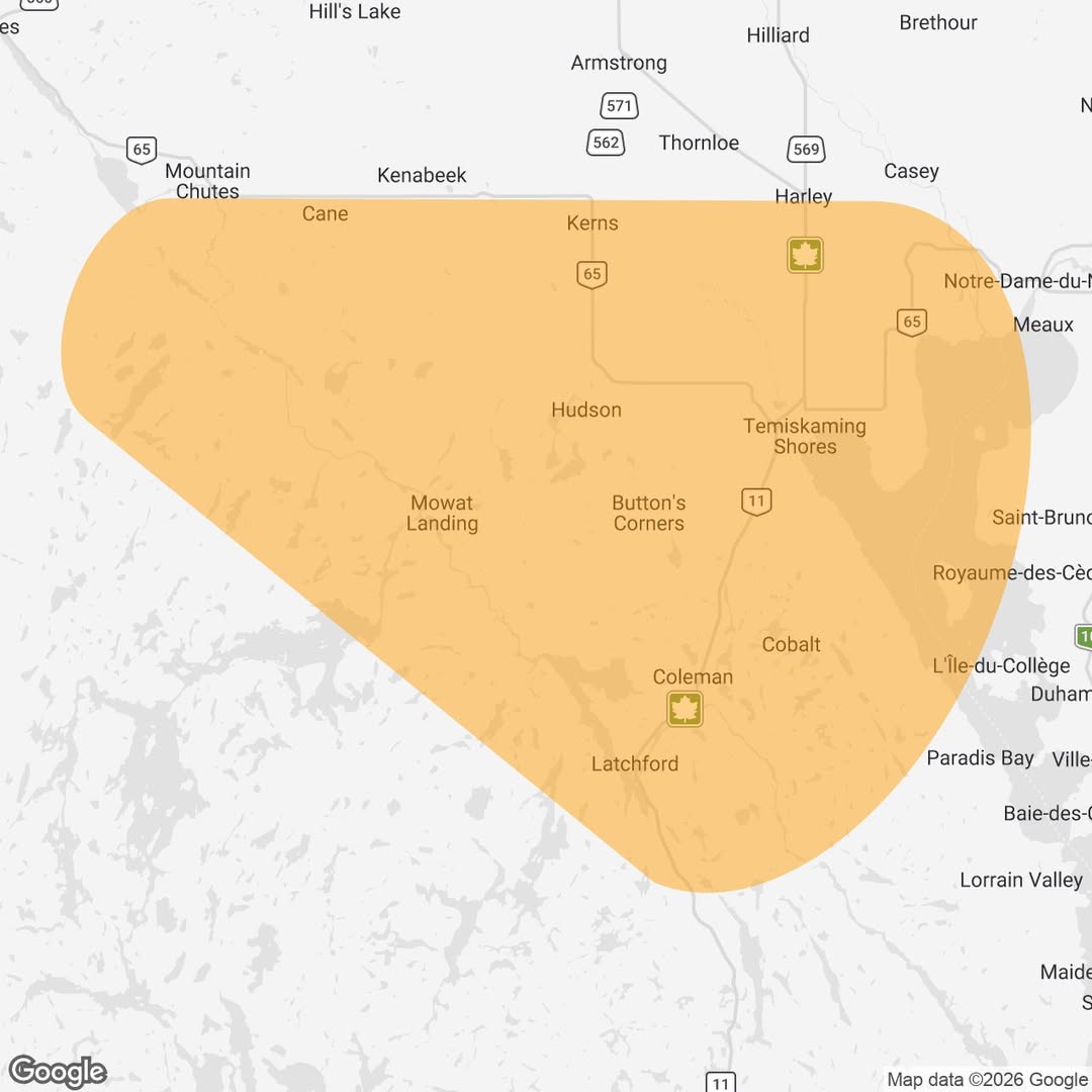

Tornado warning from Instant Weather:
A rotation has been detected on radar with a storm located 30 km west of Temiskaming Shores, ON, travelling slowly to the east towards Temiskaming Shores today, July 27.. There’s also a strong risk of flooding with this storm as it’s moving very slowly and has already produced 52mm of rainfall based on radar. And there’s quite a strong hail core on it, which could produce damage as radar is estimating golf ball sized hail.
Rotation on radar indicates the potential for this storm to produce a tornado in its lifespan. It may also have the risk for damaging wind gusts, hail, isolated flooding, and frequent lightning. Please be safe in the path of this storm. Based on radar data, this storm is potentially producing up to golf ball size hail. Radar suggests up to 52mm of rainfall has already fallen in the last hour.
– Casey
– Cobalt
– Coleman
– Gillies Limit
– Haileybury
– Harley
– Harris
– Kenabeek
– Kerns
– Latchford
– New Liskeard
– Temiskaming Shores
Tornado warning with potential for hail and flooding for Temiskaming region was last modified: July 27th, 2026 by